|
Miniscale |
MiniScale® is a clear and uncluttered national map ready for ideal for identifying national transit routes or to plot assets across a wide geographic area. |
|
|
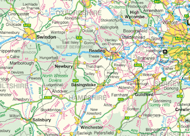
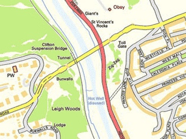
Colour Raster |
1:250,000 Scale Colour Raster, formerly OS Travel Map – Road, scanned as a set of image files. It emphasises the main roads and places of interest and is ideal for viewing a wide area, |
|
|
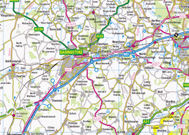
Town |
Town shows all roads and buildings as blocks of colour to allow easy identification of land features. Its clarity is particularly suited to development and land use planning, environmental analysis, vehicle routing and asset management. Town offers clear detail on roads, footpaths, woods, water features, important buildings and height contours. |
|
|
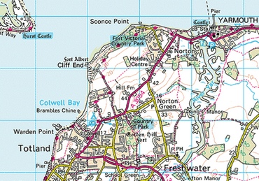
Explorer |
Explorer shows rights of way information for England and Wales, selected cycle routes and National Trail and Recreational paths, as well as detailing hill contours, height information and field boundaries. |
|
|
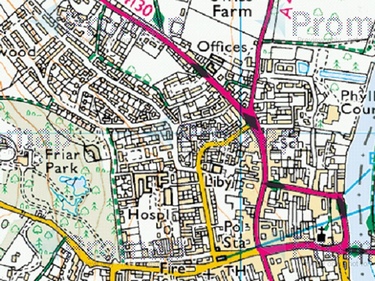
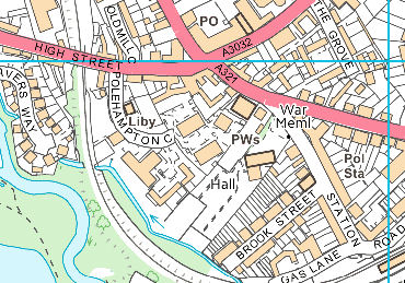
Street |
The street-level detail of Street makes it particularly useful for displaying and analysing data about specific localities. It shows clear street-level detail, including building outlines, woodland and water. |
|
|
VML Raster |
OS VectorMap® Local Colour Raster is a large-scale comprehensive map base that provides detail including fences, field boundaries, road names and buildings. It is ideal for visualising locations, detailed work, and as background mapping to add or overlay information. |
|
|
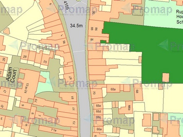
OS Detail |
OS Detail (MasterMap), shown here in colour, is comprehensive mapping showing man-made and natural features ranging from houses, factories, roads, rivers, marshland and administrative boundaries. There are over 430 million features surveyed and digitised at three different scales according to location: •1:1250 scale in urban areas •1:2500 scale in rural areas •1:10000 scale for remote areas such as mountains and moor land Viewing an OS Detail layer map is subject to charges. For further information on pricing please refer to our current online price list: www.promap.co.uk/pricing.php OS Detail can be viewed in either colour, or black and white and can be overlaid with aerial photography when in hybrid mode. |
|
|
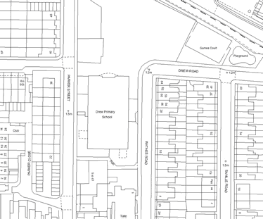
OS Detail |
OS Detail (MasterMap), shown here in black and white, is comprehensive mapping showing man-made and natural features ranging from houses, factories, roads, rivers, marshland and administrative boundaries. There are over 430 million features surveyed and digitised at three different scales according to location: •1:1250 scale in urban areas •1:2500 scale in rural areas •1:10000 scale for remote areas such as mountains and moor land Viewing an OS Detail layer map is subject to charges. For further information on pricing please refer to our current online price list: Click Here OS Detail can be viewed in either colour, or black and white and can be overlaid with aerial photography when in hybrid mode. |
|
|
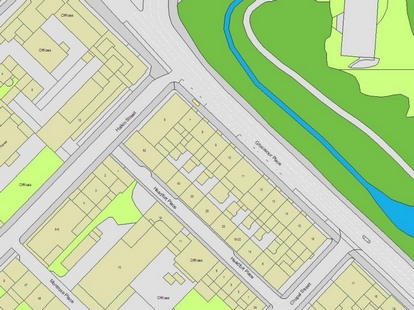
UKMap |
UKMap is a highly detailed and feature rich mapping layer. It accurately locates buildings, garages, property boundaries, roads, tress and a multitude of other features. It comprises of addresses and a retail database including above ground usage as well as providing building height datasets, aerial photography and a digital terrain model. The feature rich mapping layer has been structured for use in a wide range of applications. UKMap's topographic features have been digitised at 1:250 scale using high resolution aerial photography. The accuracy of UKMap is determined by two factors; the quality of the ortho recification and aerial imagery and the accuracy at which the data was digitised at. UKMap has a target accuracy of +/- 1m. The data has been checked by an independent GPS ground survey. |
|
|
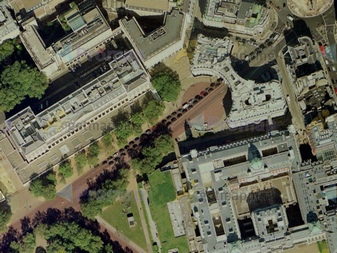
Seamless Aerial Layer |
The modern aerial photography layer at 25cm resolution provides a highly detailed overhead view.
Simply locate your site or roam to it using the seamless aerial layer, annotate using the extensive range of drawing tools and download the image that you require. The process of ordering aerial photography is easy through Promap. You can view the price and the date that the photograph was flown ensuring that you are getting the photography that best suits your requirements.
High resolution aerial imagery of 12.5cm resolution and 50cm resolution historical aerial photography from the RAF, USAAF and Luftwaffe can also be ordered through Promap Export.
The modern high quality colour digital aerial photographs are a valuable addition to printed and exported maps and provide detail down to street level, with objects such as cars and trees clearly identifiable.
|
|
|
|