
Save time on your next design
We can deliver mapping, aerial photography and 3D Models quickly in a range of CAD ready formats.
Browse product for DesignHow can Promap make design easier?
CAD compatible
All our mapping and data is available in CAD ready formats, ready to import directly into your chosen software. What’s more you can request alternative formats for free.
Quick and easy to use
We offer instant access to the most detailed mapping available in Great Britain. Our quick start guide, covers everything you need to know about exporting data.
Reliable and up-to-date
We have provided mapping to the property industry for over 20 years. Our MasterMap is updated every 6 weeks providing the most accurate view of the land.
Supporting data
We offer a variety of additional data alongside the traditional mapping options. Choose from bespoke 3D models to a range of LiDAR data.
Explore Promap product for Design
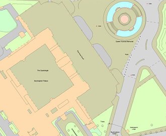
OS MasterMap®
Updated every 6 weeks, OS MasterMap® provides the most accurate view of the land. We also offer a range of other mapping layers to provide the full picture.
Browse OS MasterMap®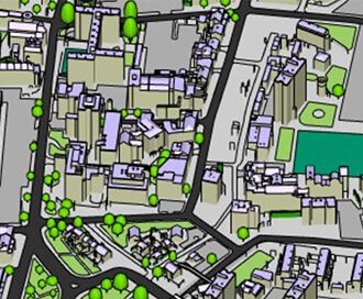
Zmapping Detailed 3D Model
High detail 3D models providing an accurate representation of the real-world.
Browse Zmapping 3D Models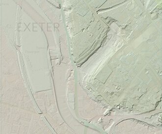
LiDAR Height Data
High accuracy mass capture dataset available in a range of resolutions and formats, including contours, suited to more detailed applications.
Browse LiDAR Height Data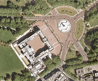
Getmapping Aerial Photography
Available in a range of resolutions and across Great Britain, Getmapping Aerial Photography is avaialble to view, print and export.
Browse Getmapping Aerial PhotographyWhat people are saying about Promap
- I always access my OS maps from Promap - I wouldn't think of going elsewhere.
- I've worked in the housebuilding industry for over 20 years and Promap has always been a service that I've used.
- All very quick and easy to do
- Promap was there when I started my career and today we continue to rely on Promap at APD for all our mapping needs; it simply does what we need it to do.
- Promap does exactly what we need it to do; it is our platform of choice.
- Promap makes our lives easier and assists us in delivering our projects on time with a high degree of accuracy.
- I can’t remember not using Promap to be honest – it’s been the application I always revert to in order to identify and measure sites, pinpoint locations calculate distances between places and calculate a distance radius from a given target.
- It is definitely a time saving tool and cost effective to our business and our clients. As a consultancy, it is reassuring to know that we have the support of Landmark’s Promap, which is always there when you need it.
What you get when you work with Promap
Nothing to install, it's all here in your browser
That's right, we're ready to go when you are. Best of all Promap now works on any modern browser or operating system.
Customer service when you need it
We're mapping geeks at heart and are always happy to help. Whether you've got a question or a problem, feel free to get in touch.
Save maps to build your own map library
Save all your maps to create your very own mapping archive. Revisit old sites at any time.
Export your map in the format you need
Our mapping is provided in a range of digital formats. Perfect for use in CAD or GIS.