
BIM Essentials
Building Information Modelling (BIM) uses information rich models and collaborative working to deliver quality data at the design and construction stage of a project.
Start using PromapExplore our range of products

LandSearch
Gather all the information that may impact your development at the touch of a button.
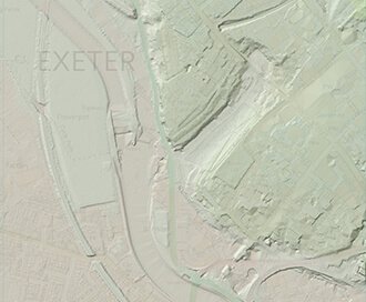
LiDAR Height Data
High accuracy mass capture dataset available in a range of resolutions and formats, including contours, suited to more detailed applications.
Browse LiDAR Height Data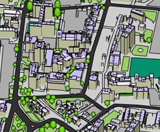
Zmapping Detailed 3D Model
High detail 3D models providing an accurate representation of the real-world.
Browse Zmapping 3D Models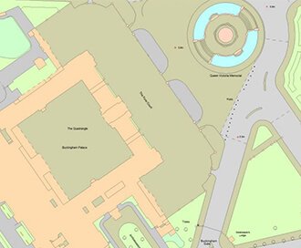
OS MasterMap®
Updated every 6 weeks, OS MasterMap® provides the most accurate view of the land. We also offer a range of other mapping layers to provide the full picture.
Browse OS MasterMap®