
High Detail 3D Model of London
Constantly Updated & Upgraded 3D London model. Data stored at customers premises for direct company-wide access.
Overview
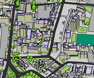
High Detail 3D Model of London is captured from the latest 2016 High-Res imagery. This model is currently the only wide area 3D model of London captured from single source survey dataset in uniform high level of detail. Customers get over 60 km2 of always updated and upgraded 3D Model of London.
The dataset is accurate to 15 cm in all axes and includes all roof features accurately captured. The terrain is captured using same photogrammetry technique and source imagery and is separated into land use. The model can be supplied as AutoCad solid .DWG, SketchUp .SKP and .FBX files for easy editing. For state-of the-art presentations and simulations, this 3D Model of London is also supplied imported into Unreal Engine 4.
Data Information
| Product Name | 3D Model of London Subscription |
| Supplier | AccuCities |
| Coverage | London |
| Typical Delivery Time |
Available now
Accucities High Detail 3D Model of London is ready in a range suitable formats within minutes.
Go to Promap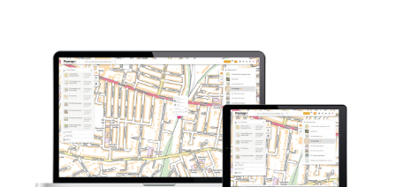
Download samples
AutoCad DWG Samples 3D London FBX Samples 3D London MAX Samples 3D London SketchUp SKP Samples 3D London
Export formats
DWG FBX MAX SKPHow can you use Accucities High Detail 3D Models?
File formats to suit your workflow
The Wide Area 3D Model is delivered in AutoCad Solid DWG, SketchUp SKP and Filmbox FBX formats for easy editing that suits most workflows. The 3D Model is easy to import into Revit, 3D Studio Max, Maya or Cinema 4D.
Company-wide Multi-use Licence
Our licence allows unlimited number of users within the company to use of the 3D Model data on multiple projects. Tailor-made for Architects, Developers and Building consultants who either work on many projects in London or require large high detail 3D Model of London for their projects.
Uniform, Detailed & Accurate 3D model
The High Detail 3D Model of London is made of Level 3 models across the entire dataset. The uniformity of level of detail is a unique feature of our wide area model. Whether your project is in Parliament Square or Elephant & Castle, the 3D model will be the same accurate and detailed Level 3 model with 15 cm accuracy.
Continual Updates & Upgrades Included
All subscribers receive updates and upgrades to the 3D model through the subscription period. Update usually contains areas of change which has been recaptured to reflect the environment today. Upgrade is usually of Buildings models from Level 3 to Level 4, but can be upgrade of a terrain file, statues or Future Skyline buildings.
Other products you might be interested in...
Zmapping Detailed 3D Models
High detail 3D models providing an accurate representation of the real-world.
Browse Zmapping 3D Models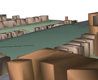
OS Detail 3D Data Bundle
A combination of three core Ordnance Survey products including MasterMap, Terrain 5 and MasterMap with Building Height Attributes
Browse 3D Data Bundle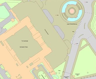
OS MasterMap®
Updated every 6 weeks, OS MasterMap® provides the most accurate view of the land. We also offer a range of other mapping layers to provide the full picture.
Browse OS MasterMap®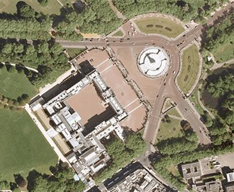
Getmapping Aerial Photography
Available in a range of resolutions and across Great Britain, Getmapping Aerial Photography is avaialble to view, print and export.
Browse Getmapping Aerial Photography