How do you get the best 3D data for your projects?
We know architects rely on drawings and models of their projects to help them to work accurately and detect and solve issues.
Traditional 2D models don’t always provide the accuracy and visual insight to identify and adapt your concepts to these challenges.
3D modelling has been recognised for many years now as the best way for architects to improve the accuracy and aesthetic quality of their designs. 3D models allow for easier and more precise concepts to develop alongside your in-depth site analysis.
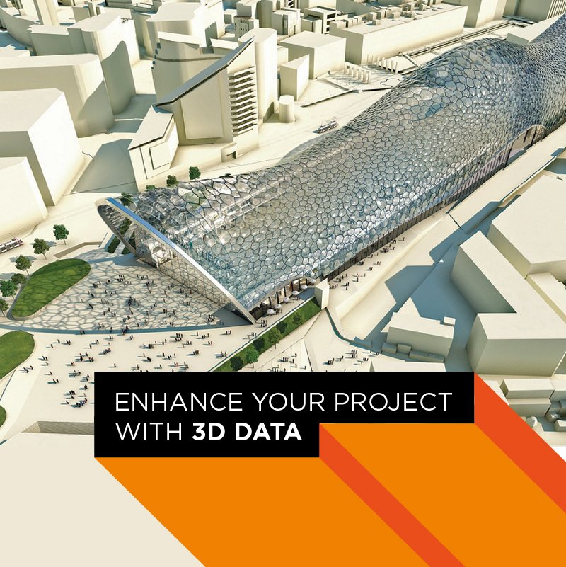
Promap and Zmapping combine accuracy and detail
Promap insists on using only the best data. We know the quality varies out there, and you can’t afford to work on data that isn’t completely accurate.
To further enhance our offering, Promap works with Zmapping for our higher level 3D city models.
Zmapping creates geographically accurate and extraordinarily detailed 3D city models for architects. By using their data on our platform, you get one of the best data sets possible.
Raju Pookottil, Director of Zmapping, says “By using a Zmapping context 3D model, it is the closest that an architect can get to designing the new development directly on top of the actual site.”
Test all the options and choose the best scenarios
Your concepts and solutions will evolve as you explore the different factors of your scenario’s environment. 3D models allow the in-depth research and analysis necessary to bring that evolution to life. Study how issues can be solved while considering their effects on the existing infrastructure.
3D enhances conceptual visualisation and allows architects to run what-if scenarios. With Zmapping data, you can place new developments in situ and see how it will affect the existing environment. Get right down to street level. Stroll down the roads and avenues you will be creating and get a genuine feel for the dynamics of the infrastructure.
Raju Pookottil explains, “by designing right within the context buildings, the architect can quickly asses views from nearby streets and carry out quick studies on any shadow impact the building could have on surrounding structures. The Zmapping models always follow actual terrain contours. This means that the impacts a sloping terrain would have on the new building or on its views from further away can be predicted early on. The models can also be quickly viewed in real-time engines, Virtual Reality headsets or they can be 3D printed with minimal work.”
You can break down your overall concept and home in on problem areas easily, taking each problem on its own, pick it apart then bring it back into the overall framework of your design.
You can test existing buildings to make sure you are compliant with London’s Right to Light, for example.
Precision and efficiency
3D models are the best way to reduce consideration time for designs. Easy to understand and explore, 3D models allow you to react quickly to issues, trial new options and present fully analysed constructs to your clients.
You’ll find you’re better able to:
- “Ask” questions of your designs
- Solve shadow and light puzzles
- Play with space
- Assess different scenarios
- Construct in a variety of materials
- Locate the best spots for key focal points
- Capture the personality and unique features of your design
Join our winning team
With Promap and Zmapping, your designs will stand out. The quality and precision of your work is its most powerful element. Let us help showcase your designs in the best possible way.