Access vital LiDAR data within the hour instead of waiting weeks for topographic surveys
Promap has been looking at ways to help developers, surveyors, and other land and property professionals become more efficient and increase their chances of successful project outcomes.
We believe the LiDAR data we supply through a quick-click Promap process is one of the most underrated ways we help.
To draw attention to this service – which means you can start exploring the potential of sites within the hour in most cases – we’ve put together a short blog series.
This part outlines how our LiDAR height data service is the quickest and most accurate alternative to waiting weeks for the topographic survey to be returned.
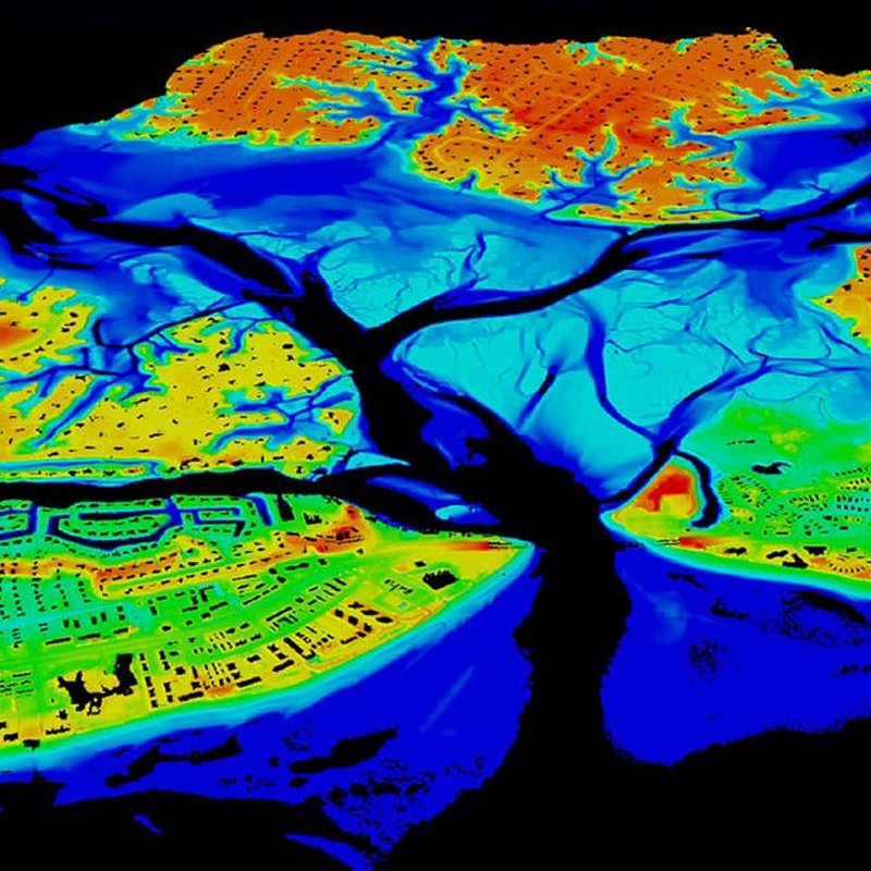
Promap provides LiDAR data
Explore and investigate sites by accessing LiDAR data within the hour in 3 clicks!
Our LiDAR data is available as a Digital Terrain Model (DTM) or Digital Surface Model (DSM). All you need to do to get access is to select the project boundary and the option for LiDAR height data to start downloading. Now you can get a feel for the land, and place it in its wider context with accurate and dependable data:
- Terrain visualisation
- Flood modelling
- Line of sight analysis
- Cut and fill analysis
Once you have studied the LiDAR data, you can make key decisions regarding the future of the project upfront. When you have a great site, you and your team can push ahead.
We realise there’s nothing like maintaining forward momentum on the most profitable and desirable sites. By taking control in this early stage, you are in a better position to drive the rest of the project.
In addition to waiting weeks for the topographic survey to be returned, other pressures are alleviated by using our services:
- Covid restrictions to site access
- Budget pressures increase as disbursements rise
- Wasting more time digitising plans
This is because with our LiDAR data:
- Inability to visit the site does not affect access to the information
- Work with data accuracy of +/-5 cm to 15 cm
- One upfront cost for more accurate budgeting – no additional disbursement costs
- We digitise the plans for you or offer multiple download formats for your convenience
You can get your LiDAR information packaged up specifically for:
- DWG 2D contours
- DWG 3D contours
- DWG LiDAR points
- TXT
- TIN
If you would like to explore projects fully without waiting weeks for the topographic survey, Promap’s LiDAR data can be used to explore constraints, risks and opportunities straight away.