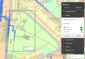
Promap Functionality
Through the viewable data layers monthly subscription the Surface Water Flooding dataset can be overlaid onto the OS Openmap, Aerial. OS Vectormap Local and OS Mastermap topography layers, included in prints and the data exported to a CSV file. The data is also utilised for the Landsearch and Sitecheck Assess reports available from Promap.
What does it provide?
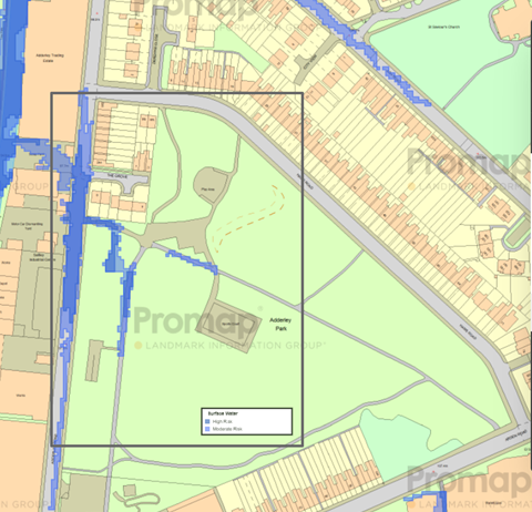
More than 80% of insurance claims for flooding over the last decade have been caused by surface water flooding. This dataset indicates the overall extent of a surface water (pluvial) flood event. This map assesses flooding scenarios as a result of rainfall with a 1 in 30, 1 in 100 and 1 in 1000 chance of occurring in any given year.
Dataset Name: Surface Water Flooding
Supplier: Environment Agency, Natural Resources Wales and Leading local flood authorities.
Coverage: England and Wales
Update Cycle: As notified by the suppliers
Free or Subscription: Free within Promap
See samples of the Surface Water Flooding data in action in :
Landsearch – Click Here
Sitecheck Assess – Click Here
Viewable Layers – Click Here